Perspectives
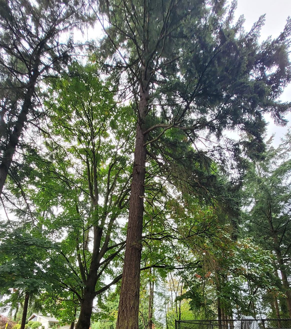
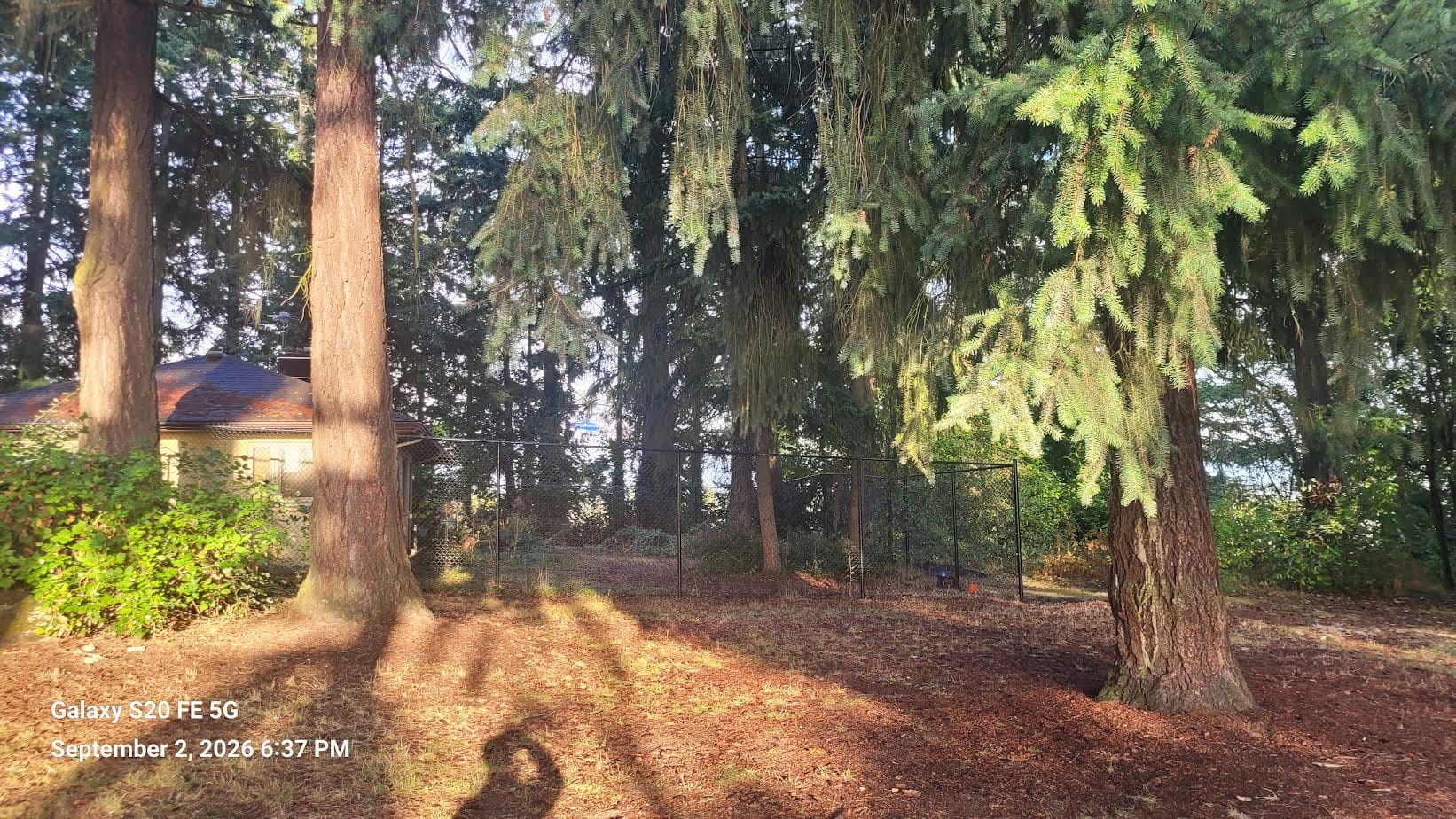
Six Douglas fir trees in Mathison Park, at 533 South 146th Street in Burien, are scheduled to be cut down this fall. The reason: they have been deemed too tall and a safety hazard for Sea-Tac Airport.
The City of Burien will remove the trees at the direction of the Port of Seattle, which is implementing Federal Aviation Administration rules. On paper, six trees may not sound significant. But after visiting the park, looking at the maps and talking with a member of the family that donated the property, I came away thinking about how remarkably small the margins are—and how airport expansion continues to have unanticipated impacts on the surrounding community.
This entire process has been going on for years and is profiled on
Seatac Noise Info. The tree removal is part of the Port's Flight Corridor Management Program. In addition to the general page, the Port created a specific page for Mathison Park
Every five years, the Port evaluates trees within designated airport safety areas. Trees already above a specified height—or projected to exceed it within five years—must be removed. The Port estimates roughly 3,000 trees will eventually be removed through the program and is just over halfway through that work.
The Box
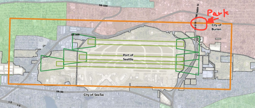
Note how the area literally runs through the middle of the park (just to the right of SF-518).
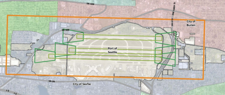
Looking at the map for Mathison Park, I was struck by what I call "the box": the orange grid defining the safety area.
It reminded me of other straight lines on maps that make little sense when viewed from the ground. Point Roberts is part of Washington even though reaching it by land requires traveling through Canada. Forest maps still show checkerboard patterns created when the federal government granted land to railroads during westward expansion.
Looking at Mathison Park, my thought was: here we go again. Someone creates rules, draws lines on a map, and locals are left to deal with the consequences.
The safety-area boundary literally cuts through the park, including the playground area and the former Mathison family residence. The Mathison family donated the park property to the City of Burien.
What surprised me even more was how close the trees are to the boundary.
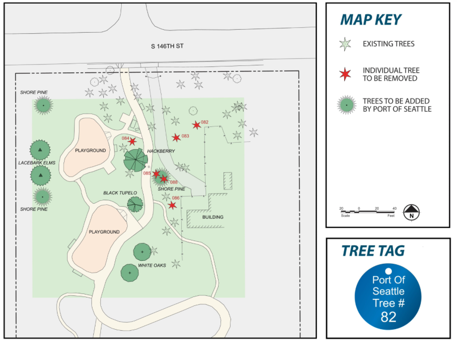
I paced from the edge of the safety area, which roughly aligns with the west side of 5th Place South, to the first tree scheduled for removal. It was about four paces—roughly nine feet. My estimates for the other trees ranged from approximately 23 feet to 70 feet inside the boundary.
The east-west width of the safety area is about a mile. Nine feet is roughly 0.2 percent of a mile; 70 feet is about 1.3 percent.
That left me wondering: does nine feet out of a mile really make a meaningful difference for aviation safety? What about 70 feet?
Standing in the park and watching planes, the airport feels surprisingly distant. My estimate is that the normal landing path is at least 2,000 feet east of the tree-removal area. If the Third Runway had been built slightly farther east, or if the safety area were marginally narrower, these trees would apparently fall outside the zone.
I understand the need for aviation safety. But looking at the terrain raises questions about how these safety zones are determined and how much local conditions and actual flight paths factor into the rules.
A Family's Perspective
Eric Mathison, a member of the family that donated the park and a longtime family friend, has written about the planned tree removal. I contacted him and arranged to walk through the park together.
Eric talked about growing up there, walking to Sunnydale Elementary and Highline High School, and playing in the woods. He remembers relatively little airport noise until the 1970s, when Sea-Tac's second runway opened.
Hearing those stories makes the issue feel different. These aren't simply six dots on an airport planning map. They're part of a landscape with a history.
What Replaces the Douglas Firs?
The Port is paying for nine replacement trees. Two will be planted in a meadow, five along the western perimeter fence outside the safety area, and two near where trees are being removed.
But replacing six mature Douglas firs with nine smaller trees isn't necessarily an ecological one-for-one exchange.
The City of Burien hired an arborist to develop the replacement plan. The city's rationale includes increasing species diversity so that a pest or disease affecting one species won't destroy the entire grove. Another consideration is choosing trees that will not eventually grow high enough to create another aviation conflict.
Eric has raised another concern: most of the replacements are not native to the Pacific Northwest.
I asked both the Port and the city for local examples showing where these tree species have been successfully planted in comparable conditions. Neither provided examples, instead relying primarily on the arborist's recommendations.
There is also the question of carbon storage. Mature Douglas firs absorb and store carbon, intercept rainfall, and provide habitat and shade. Replacement trees will take years to grow, and because they are deliberately selected to remain shorter, their long-term ecological role will be different.
The six trees also occupy a relatively small portion of this five-acre park—roughly a 45-by-60-foot area—but that location matters. They provide shade around the children's play structure and nearby picnic tables. Removing them could noticeably change how that part of the park feels for years.
Go Visit Now
One challenge in writing about Mathison Park is magnitude. If the Port's larger program involves thousands of trees, do six trees matter?
I think that's the wrong way to look at it.
These six trees illustrate something larger: how broad rules and straight lines drawn on maps eventually intersect with actual places, ecosystems and people's histories.
I don't pretend to have the technical expertise to decide exactly where an aviation safety boundary should be. But standing beneath these Douglas firs, only a few feet inside an invisible line on a map, makes the consequences of that line remarkably tangible.
The Port's tree-removal program will continue, and replacement trees may gradually change the character of forested areas near the airport.
So my closing suggestion is simple: go visit Mathison Park.
Stand beneath the Douglas firs. Look through them toward the airport. Walk the short distance to the edge of "the box."
Then consider what nine feet on a map can mean on the ground.
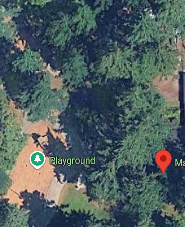
It is hard to describe or photograph this scene. Maybe one of the best views is from Google maps, showing the current tree cover and brown grass where the playground is located. My estimate is that the brown area will fill most of the right side of this image for many years,.
Members Discussion
Highline Journal Comment Guidelines
We believe thoughtful conversation helps communities flourish. We welcome respectful, on-topic comments that engage ideas, not individuals. Personal attacks, harassment, hateful comments, directed profanity, false claims, spam, or sharing private information aren't allowed. Comments aren't edited and may be removed if they violate these guidelines.